Lauren Davis
MArch Architecture
Knowledge-Scapes
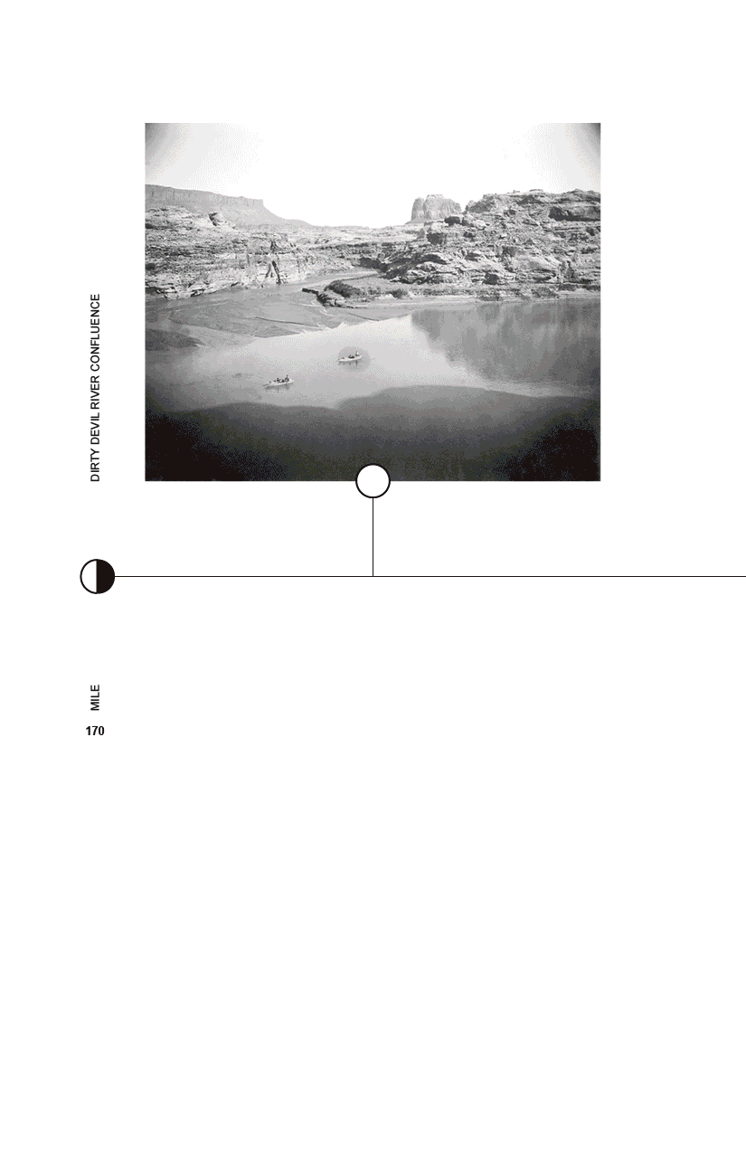
Knowledge-Scapes is a project invested in how narratives of landscapes are constructed, and uses architecture as a means of mediating meaning to complex environments. Nature in the American landscape is often framed through a mythology of the untouched wilderness, where national parks and monuments are presented as places preserved from human intervention. This narrative is reinforced through the ways these places are often visited, with scenic overlooks and image-driven encounters presenting the landscape akin to a backdrop. Yet dams, highways, and extraction networks have fundamentally transformed American land while often remaining cropped from view. This thesis examines Lake Powell, a dammed stretch of canyon along the Colorado River, as a site highly affected by these forces. As the reservoir continues to undergo dramatic change from drought, Glen Canyon is reemerging not as it once was, but as a new landscape shaped by shifting ecologies and infrastructural traces.
In response, the project proposes a distributed network of small research stations and shelters positioned along the river corridor. These low-impact structures collect environmental data, harvest solar energy, gather water, and invite visitors to engage with the canyon through action and journey. Each structure acts as a different character within the landscape, creating new ways to experience and understand the evolving environment.
The project reframes recreation as a form of knowledge-making. Through movement, pilgrimage, and encounters with these mediating structures, visitors embody the canyon as an active and changing system rather than a scenic backdrop. Ultimately, the thesis explores how architecture can make environmental processes more visible, experiential, and collectively understood, fostering new narratives of care between people, infrastructure, and the landscapes they shape.
Image
Animated archive of photographs documenting movement through the Glen Canyon river corridor. The upper images depict Glen Canyon before the damming, showing landscapes and river passages that are now inaccessible beneath the Lake Powell reservoir. The lower images show the same canyon system after flooding, tracing the transformation of the landscape through dam infrastructure, water, and changing environmental conditions. Digital animation.
Image
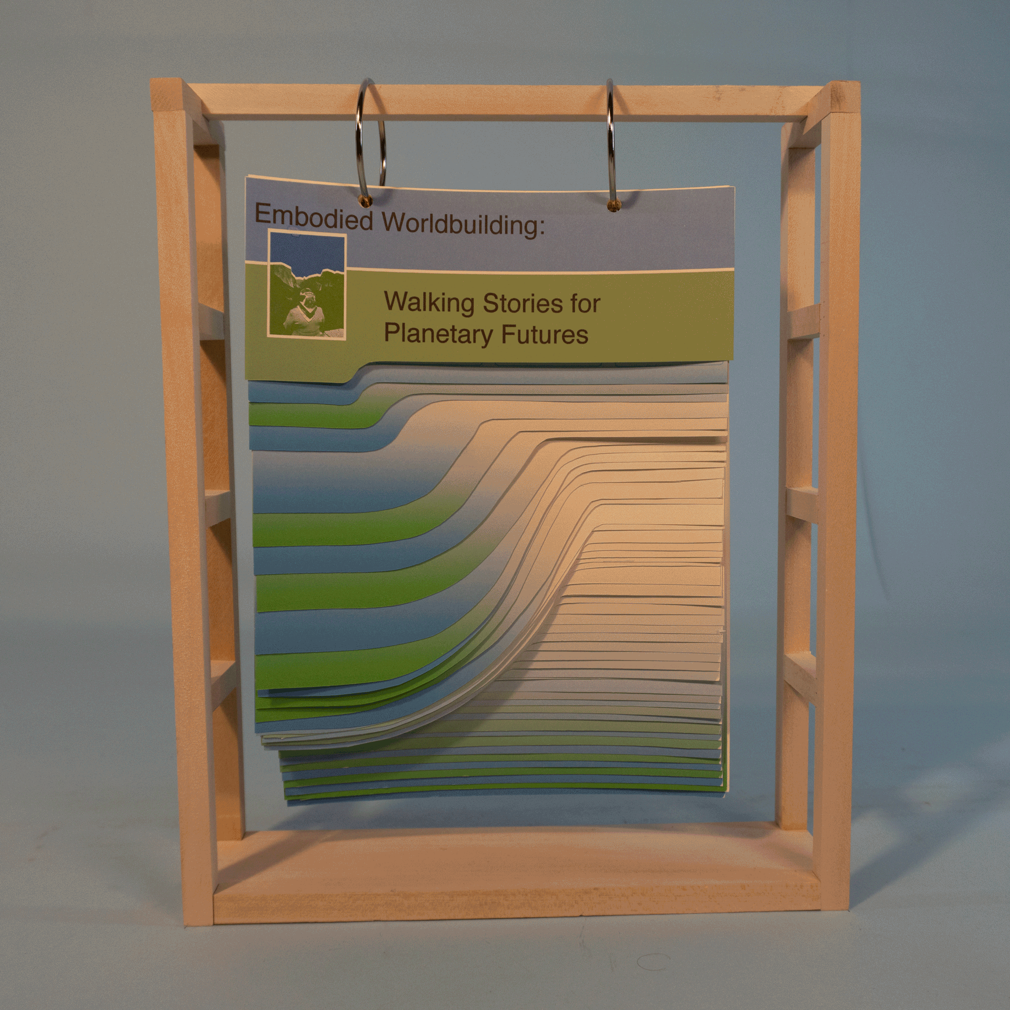
Research book compiling studies of worldbuilding in architecture, mapping representation, and histories of walking as tools for communicating environmental and cultural narratives through movement, observation, and storytelling. The book constructs a landscape of its own through using the pages to form a topographical map, and is hung from a scaffold to express the language of a billboard. Printed publication.
Image
GIF illustrating four mediating roles positioned throughout the Glen Canyon river corridor. Each architectural character responds to specific environmental conditions while contributing to a broader system of environmental storytelling and data collection across Lake Powell and the Colorado River corridor. Digital drawing.
Image
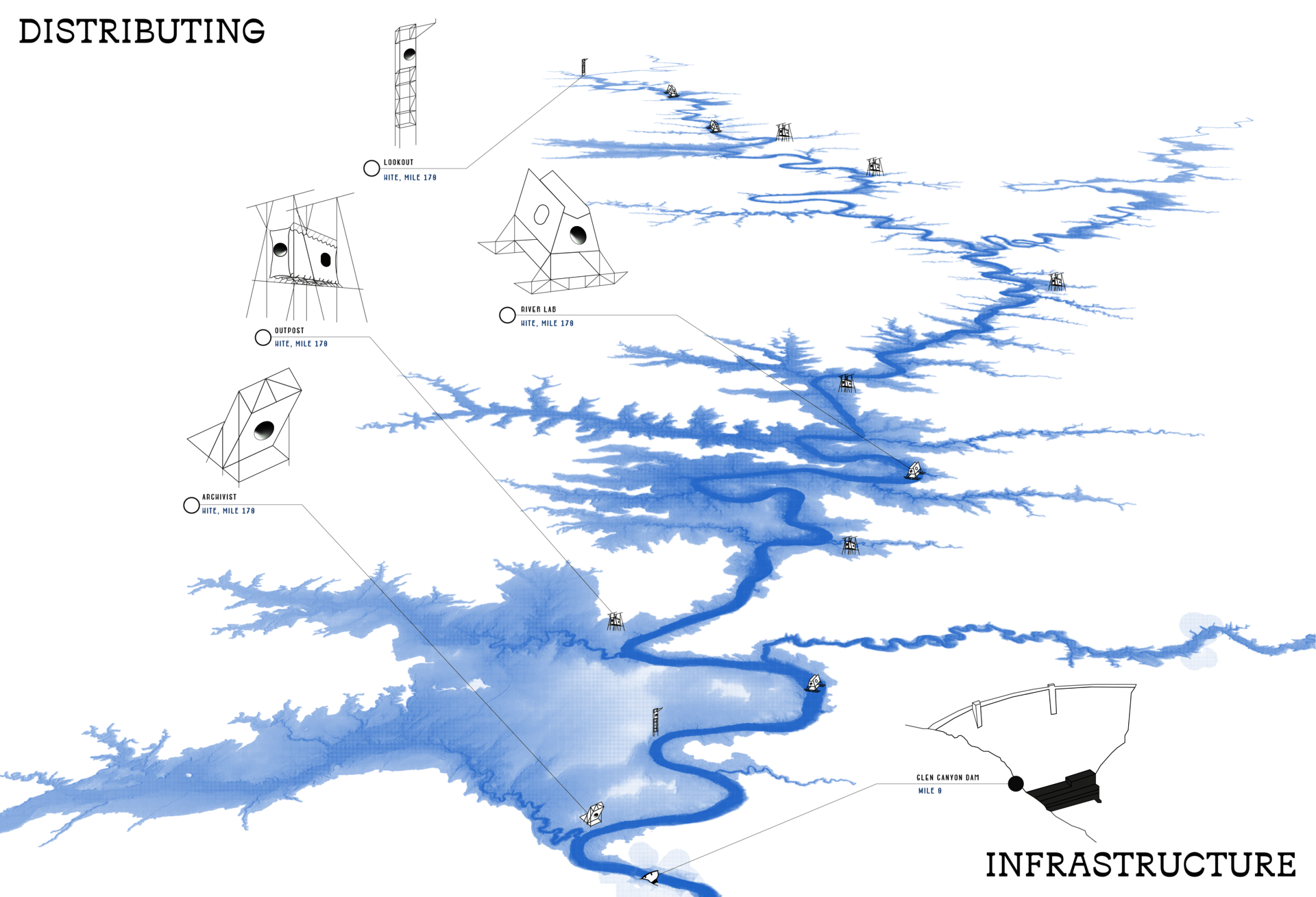
Territorial drawing illustrating a distributed network of mediating infrastructures positioned throughout the Glen Canyon river corridor. The project proposes a series of low-impact architectural characters, which support environmental observation, research, recreation, and long-duration travel through the landscape. Positioned at varying river miles along Lake Powell, these structures create new relationships between visitors, ecological systems, and infrastructural traces embedded within the canyon. The drawing situates the project across the larger territorial scale of Glen Canyon and the Colorado River system. Digital drawing.
Image
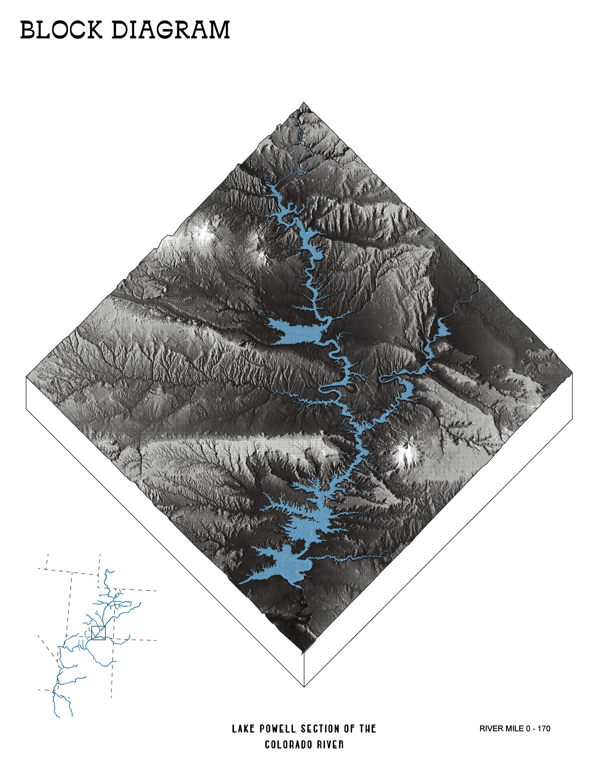
Axonometric block diagram mapping the Lake Powell section of the Colorado River corridor from river mile 0–170. The drawing represents canyon topography in grayscale while highlighting the river and reservoir system in blue, illustrating the spatial relationship between Glen Canyon’s geological formations and the infrastructural transformation created by Lake Powell. The diagram situates the thesis site within a broader territorial and environmental context, emphasizing the scale of hydrological infrastructure across the landscape. Digital drawing.
Image
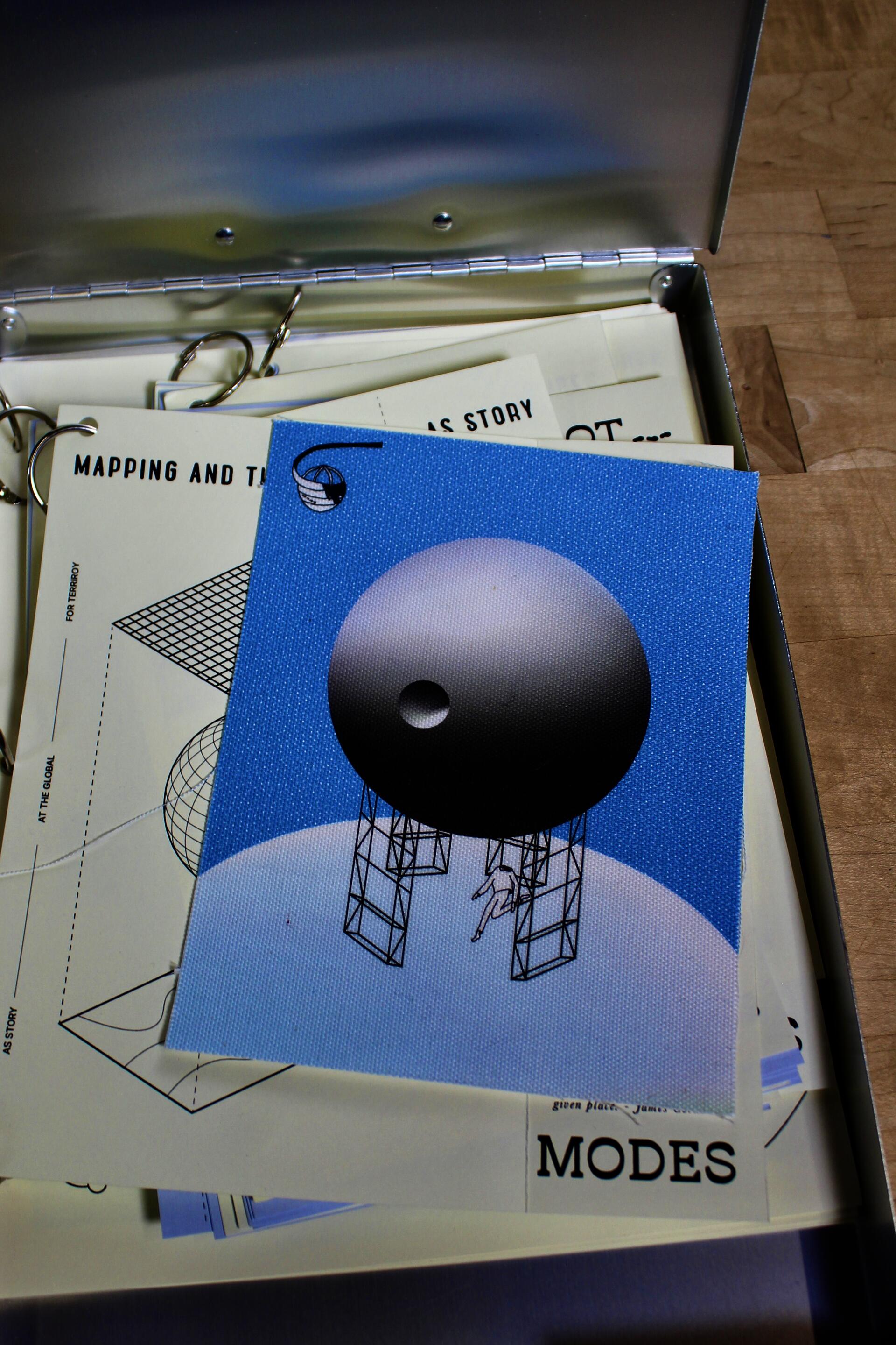
Interactive thesis book and research archive exploring walking, mapping, environmental storytelling, and worldbuilding methodologies within the Knowledge-Scapes project. The collection compiles drawings, diagrams, fold-out studies, and printed research investigating pilgrimage, environmental representation, and the role of architecture in constructing narratives of landscape. Designed as a tactile and navigable object, the archive frames research within the language of a logbook. Mixed media printed publication and assembled research materials.
Image
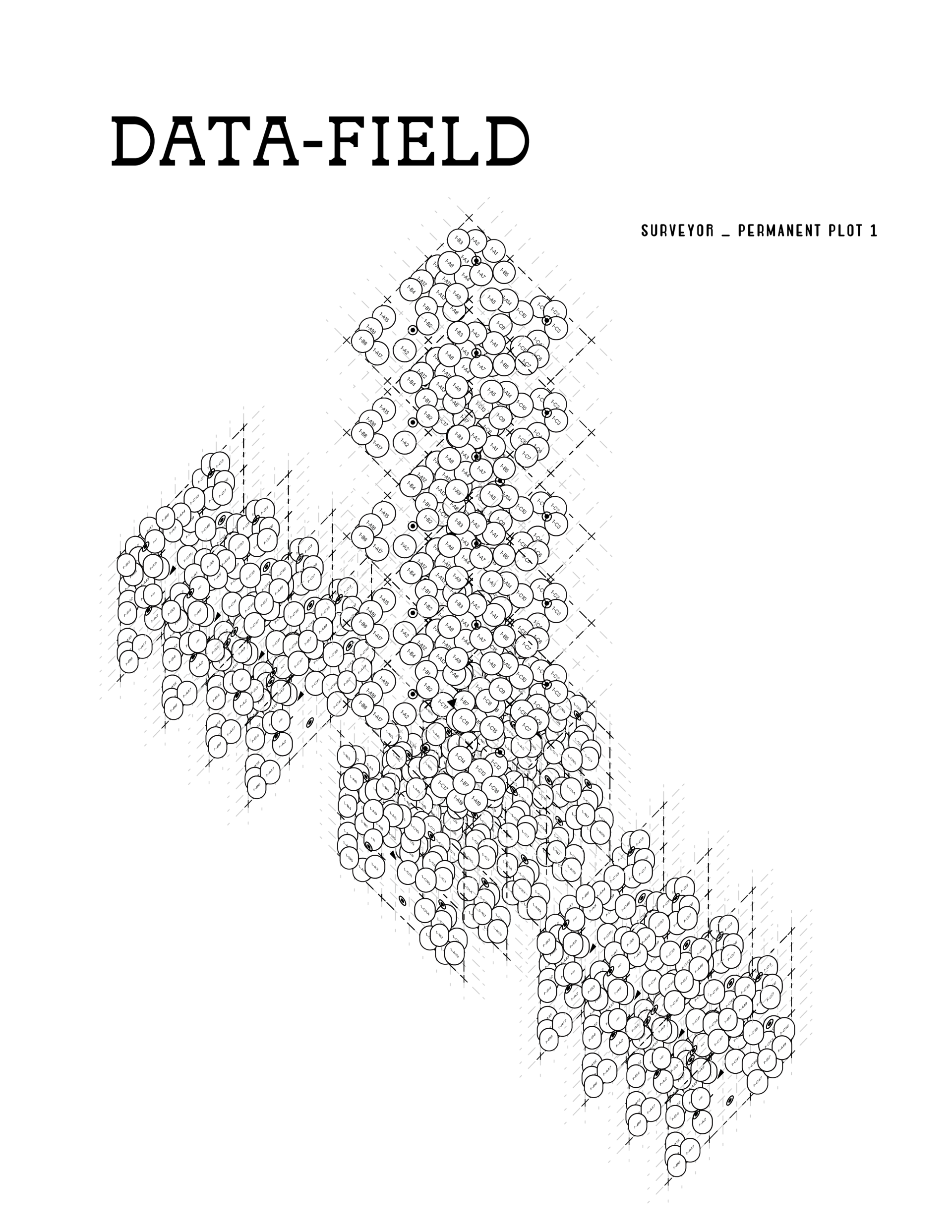
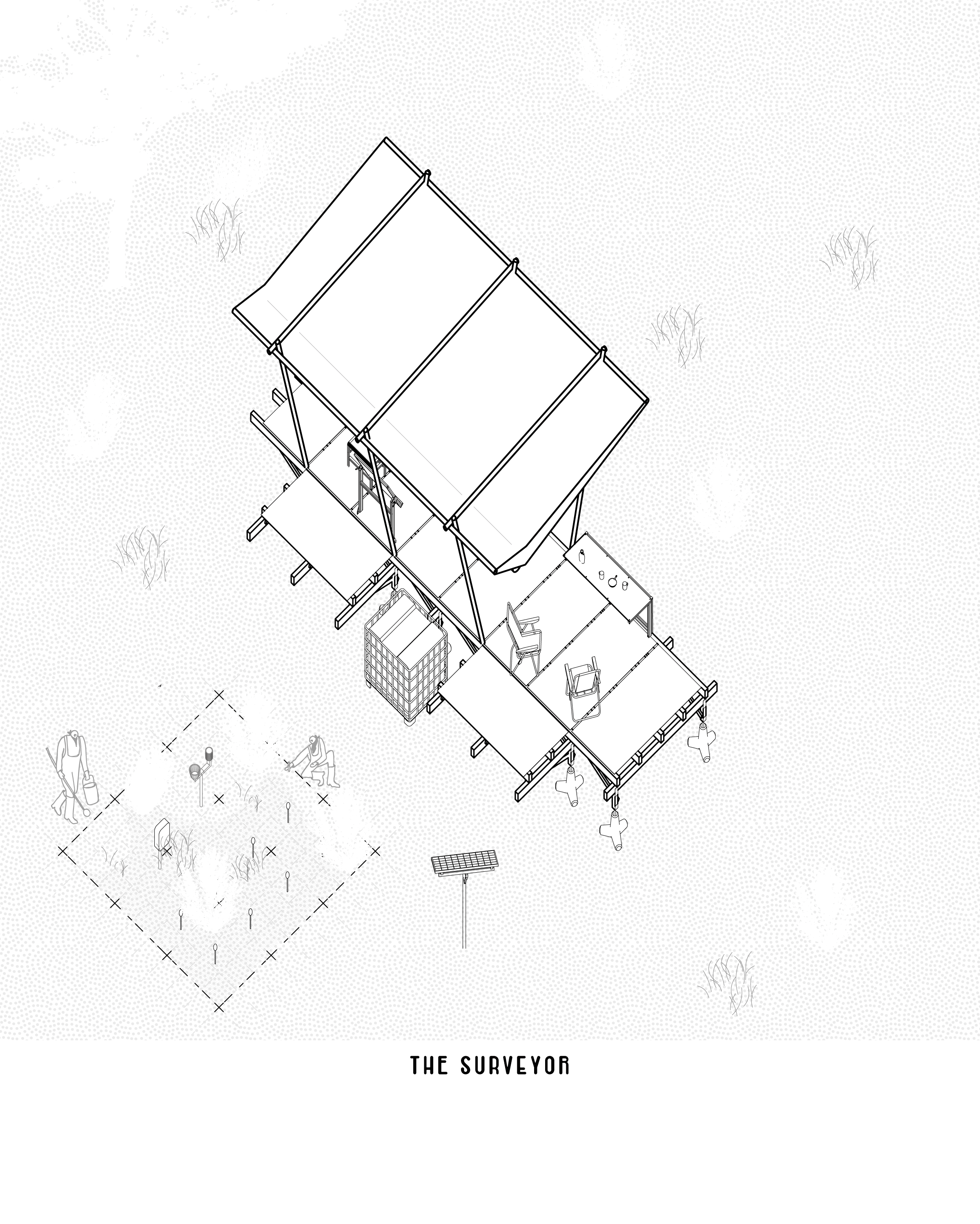
Abstract axonometric drawing visualizing ecological data collection within the Knowledge-Scapes project, collected by the "Surveyor" character. The image layers gridded fields and circular markers to represent environmental measurements, riparian studies, and mapping processes gathered along the Glen Canyon river corridor. The drawing explores how data can move beyond technical representation to become spatial and experiential, translating environmental information into a visual landscape. Digital drawing.
Image

Axonometric collage mapping architectural, environmental, and representational research precedents within the Knowledge-Scapes project. A series of billboards are distributed along a continuous pathway, organizing references related to mapping, ecology, atmospheric studies, walking, and environmental storytelling. The drawing explores how knowledge is constructed through movement, visual representation, and spatial sequencing, framing research itself as a navigable landscape. Digital drawing.
Image

Rhode Island School of Design
20 Washington Place
Providence, RI 02913–2784
United States of America
+1 401 454 6100
+1 800 364 RISD
QUICK LINKS
risd.edu
Graduate Studies
Image
Rhode Island School of Design
20 Washington Place
Providence, RI 02913–2784
United States of America
+1 401 454 6100
+1 800 364 RISD