Maria de Jesus Lopez Vazquez
MLA Landscape Architecture
Weaving Grounds: Connecting canyons and empowering borderland community
Enacting a three-phased approach, I am subverting the Mexico-United States political divide, utilizing fibers to mend the ground of the borderlands that have historically been sacrificial and empowering their inhabitants to steward both sides holistically as a unified landscape. As national policies materialize in the borderlands, Willow Canyon is one of the many forgotten landforms that has lost functionality, as it no longer conducts the sediment and water that feed the Tijuana River Estuary on the North side of the physical wall, resulting in dry patches and mineral starvation. The territory, not only severed by politics but also by urbanization, is now divided into three distinct sections of the same Willow Canyon: the South and North sections on the Mexico side, and Yogurt Canyon on the U.S. side. This divide is further deepening the disconnection between people and land, as official policies treat it as a no-man's land.
My scope is in the first Weaving Phase: Activating the three parts of the Canyon in a reciprocal relationship, helping one another to restore the hydrological flow, and connecting the community to the land. Through a Willow Terracing system, willows are planted in Yogurt Canyon, on the U.S. side, as a crop to create the woven terrace system on the South and North sides, inviting the community to participate in stewarding the land on both sides of the political divide, mending and weaving it in such a way as a reminder that nature has no borders. The remnant, or the excess sediment stuck by the physical wall and damaging the function of Willow Canyon North, is now used in sediment bags as planting media placed in Willow Canyon South. Liberated from a concrete-lined channel, it becomes a complex ecosystem that infiltrates water, holds soil, and attracts wildlife, benefiting the community.
Image
Irrelevant Line
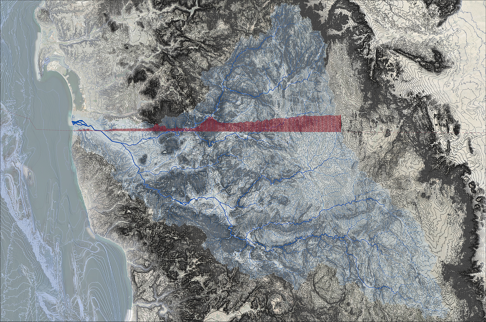
This map shows the extend of the International Tijuana River Watershed, shared between Tijuana (BC, MX) and San Diego(CA,US). The profile shows the political divide and the elevations it traverses. The irrelevancy comes when you think about putting borders across a watershed.
Image
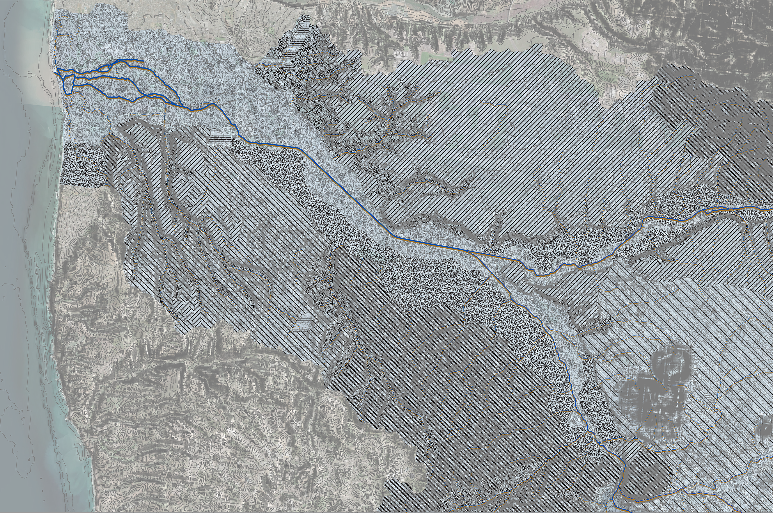
Woven Geomorphologies
Zoomed In Map of the Tijuana River Watershed, showing the seasonality of the main channels near the estuary mouth. Landforms are showed in different hatches, effectively showing that land is the same on both sides of the border, a border that can't be traced in this map.
Image
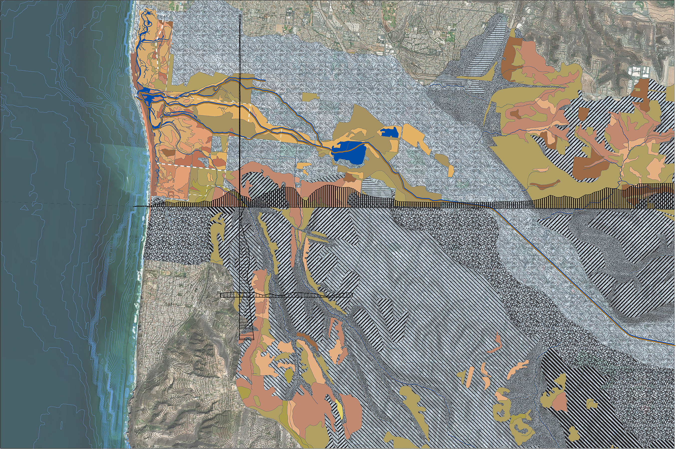
Endemic Border Vegetation
Looking at the location of the different types of endemic vegetation and how the political divide and urbanization has negatively affected the vegetation spread.
Image
Context Map
International Willow Canyon is bisected by the political divide and urbanization. Connecting the hydrological function of this canyon is imperative for mending the border grounds. Willow is the link between culture and ground, as it amends the soil, in north of the border, it repairs the ecology south of the border and holds soil in a terracing system across the road, this repair requires community and land, weaving histories together.
Image
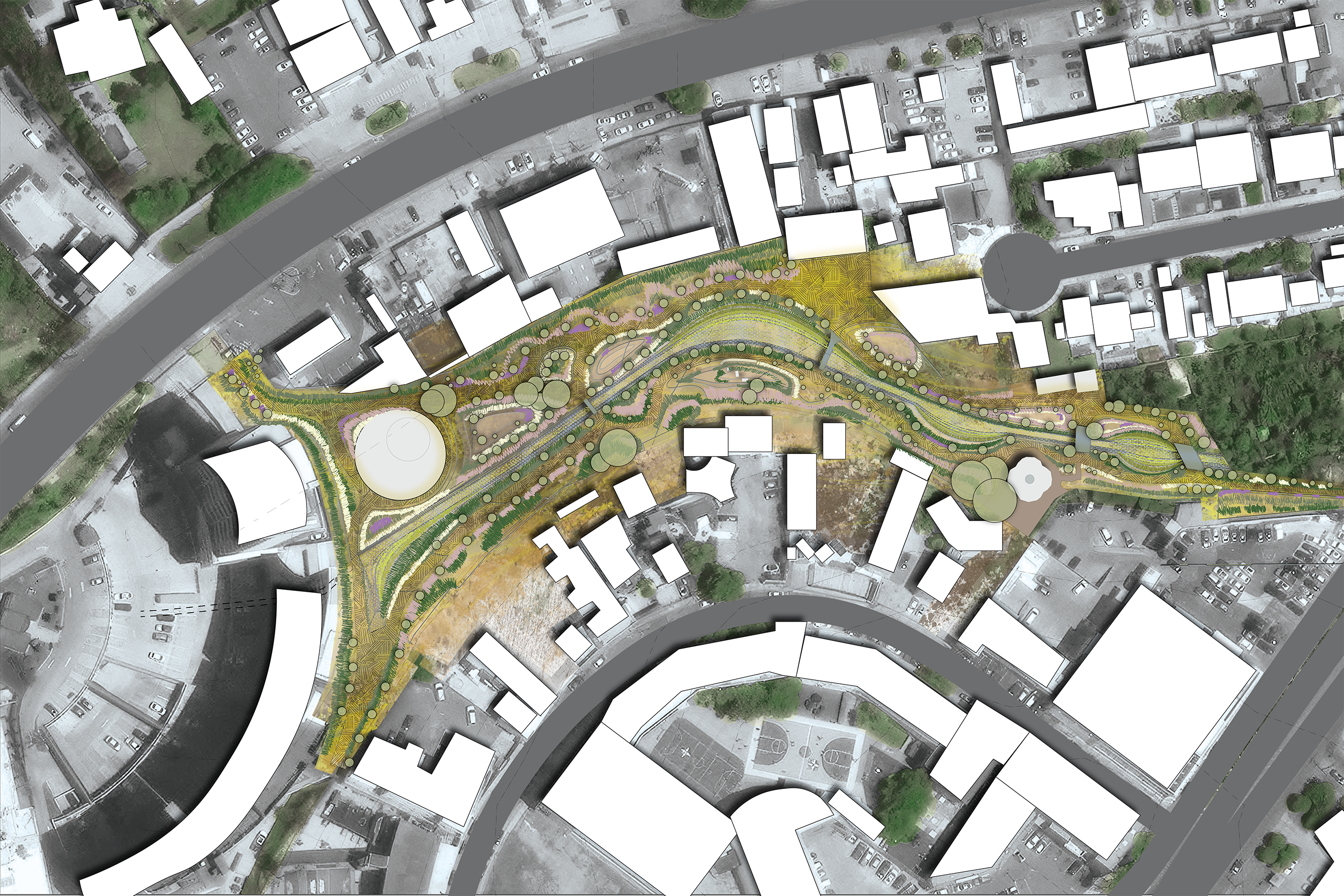
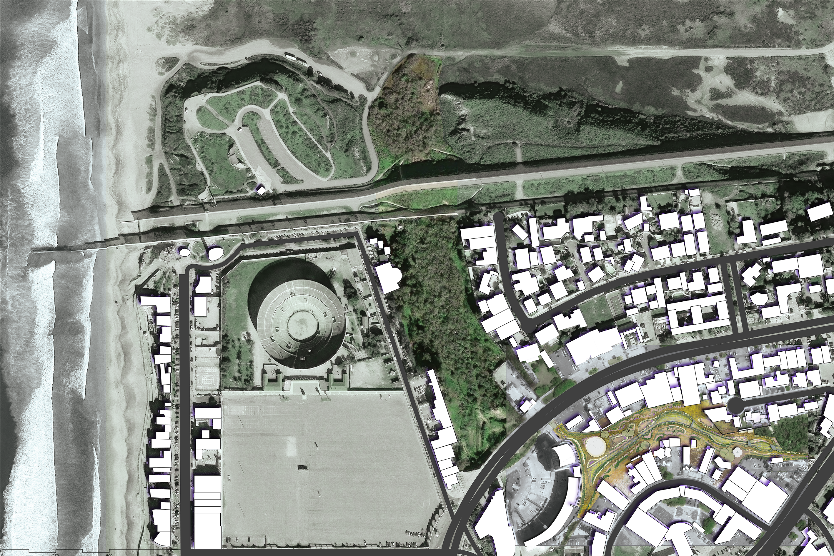
Site plan
Proposed Design intervention at Willow Canyon South showing a naturalistic channel and a terracing system reinforcing the sides. Integrated with the context of the community, making it the park in my backyard.
Image

Rhode Island School of Design
20 Washington Place
Providence, RI 02913–2784
United States of America
+1 401 454 6100
+1 800 364 RISD
QUICK LINKS
risd.edu
Graduate Studies
Image
Rhode Island School of Design
20 Washington Place
Providence, RI 02913–2784
United States of America
+1 401 454 6100
+1 800 364 RISD