Mary Ritchie
MLA Landscape Architecture
Touching Ground: Embodied Methods of Design
What forms of knowledge emerge through embodied engagement with material and the context it is situated within?
How might we practice landscape architecture if embodied, place-based knowledge were treated as integral rather than supplementary to the design process?
This thesis argues that landscape architecture must more intentionally integrate embodied, outdoor practices into the design process in order to foster a deeper understanding of and engagement with the primary medium of the field: the land itself. When we study a site through digital means, we detach our bodies and minds from the physical material we are working with. Embodied practices encourage a slower, more attentive mode of observation that engages both mind and body through tangible actions and sensory experiences. Through physical touch and sensory engagement, we gain insight into a place across many scales, from the granular texture of soil to the vast networks each microscopic particle is entangled within. By engaging in alternative modes of observation, I aim to study how a hyper-situated understanding of place can inform design practices that are adaptive and responsive to the existing conditions shaping and influencing the boundaries of a site.
Image
Touching Ground: Embodied Methods of Design
2026
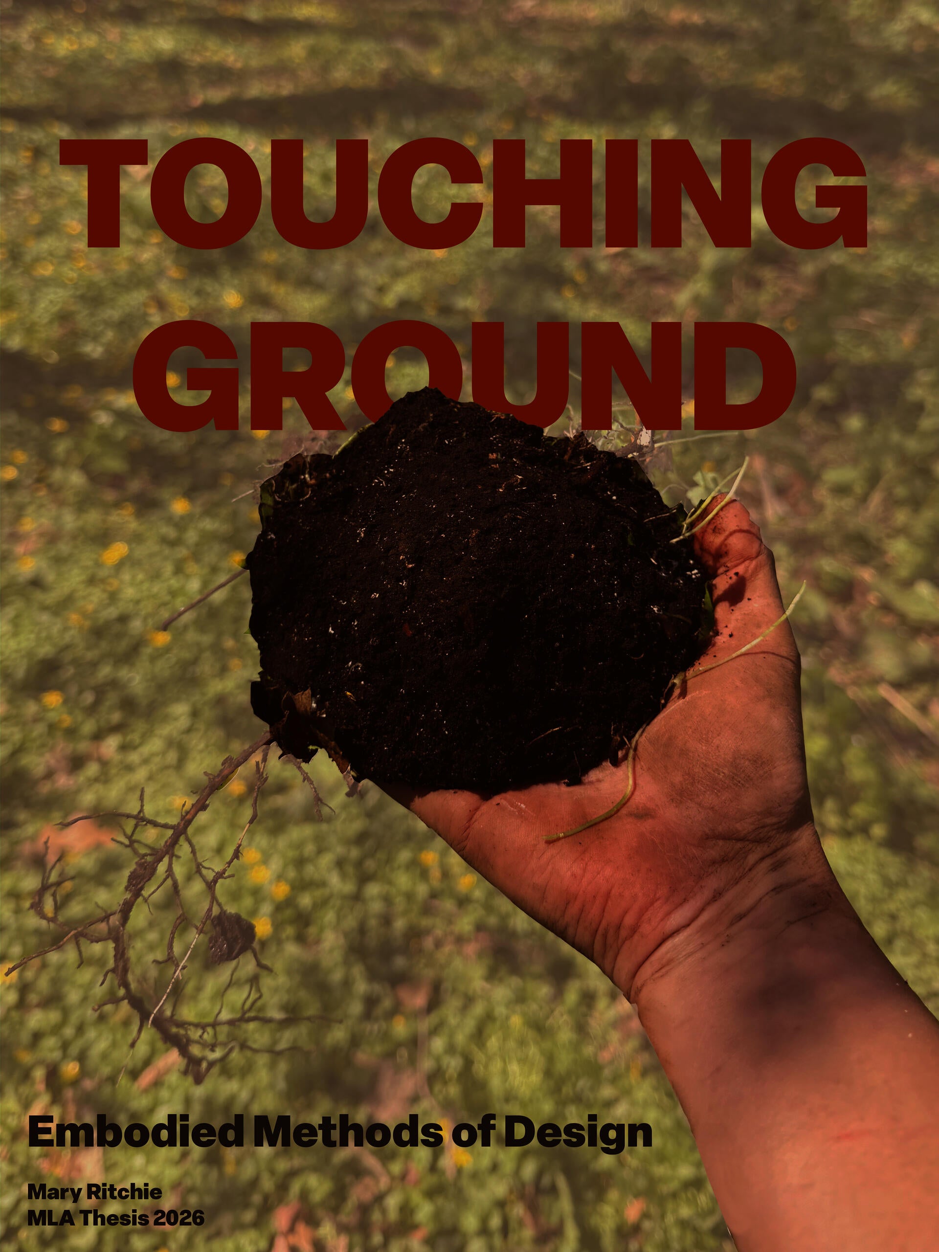
Cover image for MLA Thesis
The image introduces the thesis focus on tactile engagement, embodied observation, and material-based methods of site investigation in landscape architecture. Digital photograph with text overlay.
Image
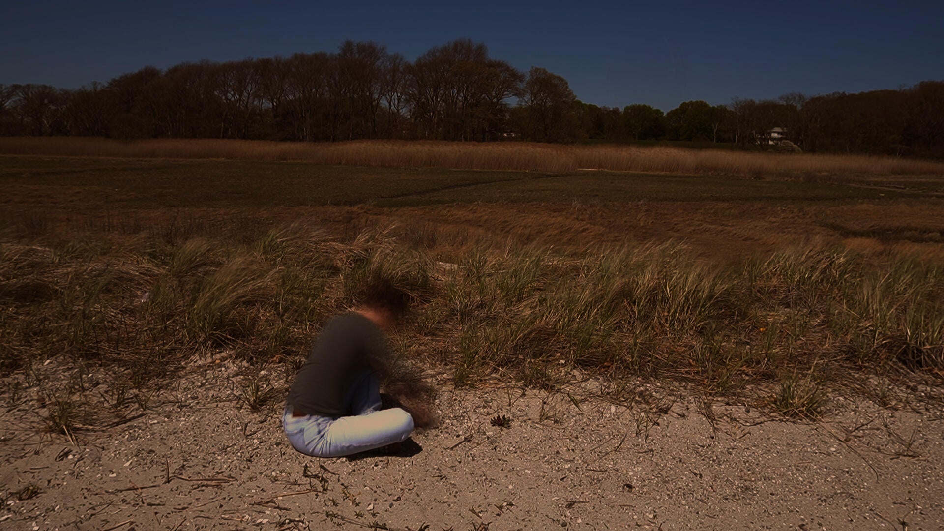
Touching the Dune
Digital video stills
Frames from a video documenting a fieldwork process at RISD Beach. The video shows the process of making of a bowl-shaped form directly in the sand at the front of the dune. The work explores tactile engagement, site observation, and material-based methods of understanding landscape through touch and making.
Image
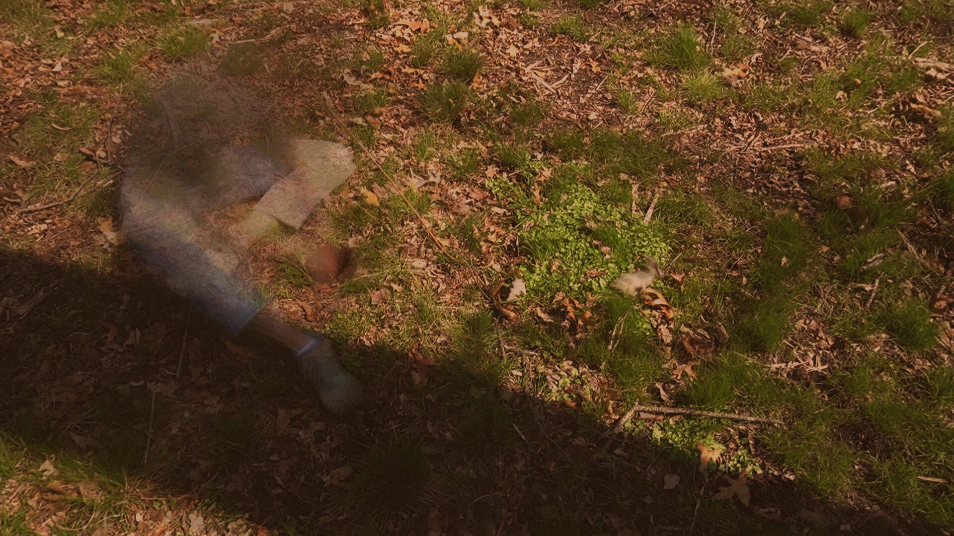
Touching the Forest
Digital video stills
Frames from a video documenting a fieldwork process at RISD Beach. The video shows the process of making of a bowl-shaped form directly in the forest floor. The work explores tactile engagement, site observation, and material-based methods of understanding landscape through touch and making.
Image
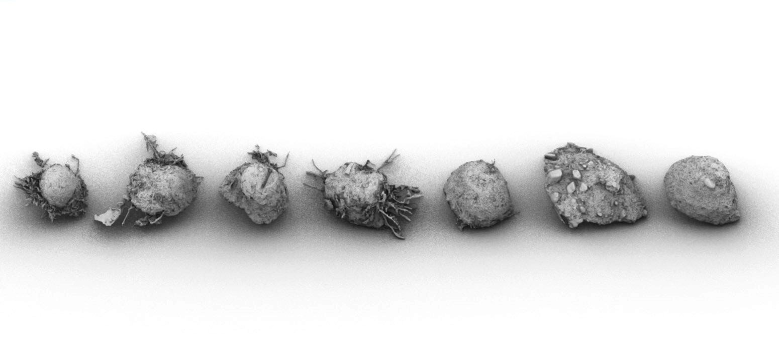
Transect of Ground Casts
A series of 3D scans of plaster casts made from bowl-shaped impressions formed directly in the ground along a transect through the landscape. By moving across different points in the landscape, the casts reveal variations and relationships between form and texture at a granular scale. Together, the collection functions as a tactile mapping tool that captures embodied observations and material traces of the environment.
Image
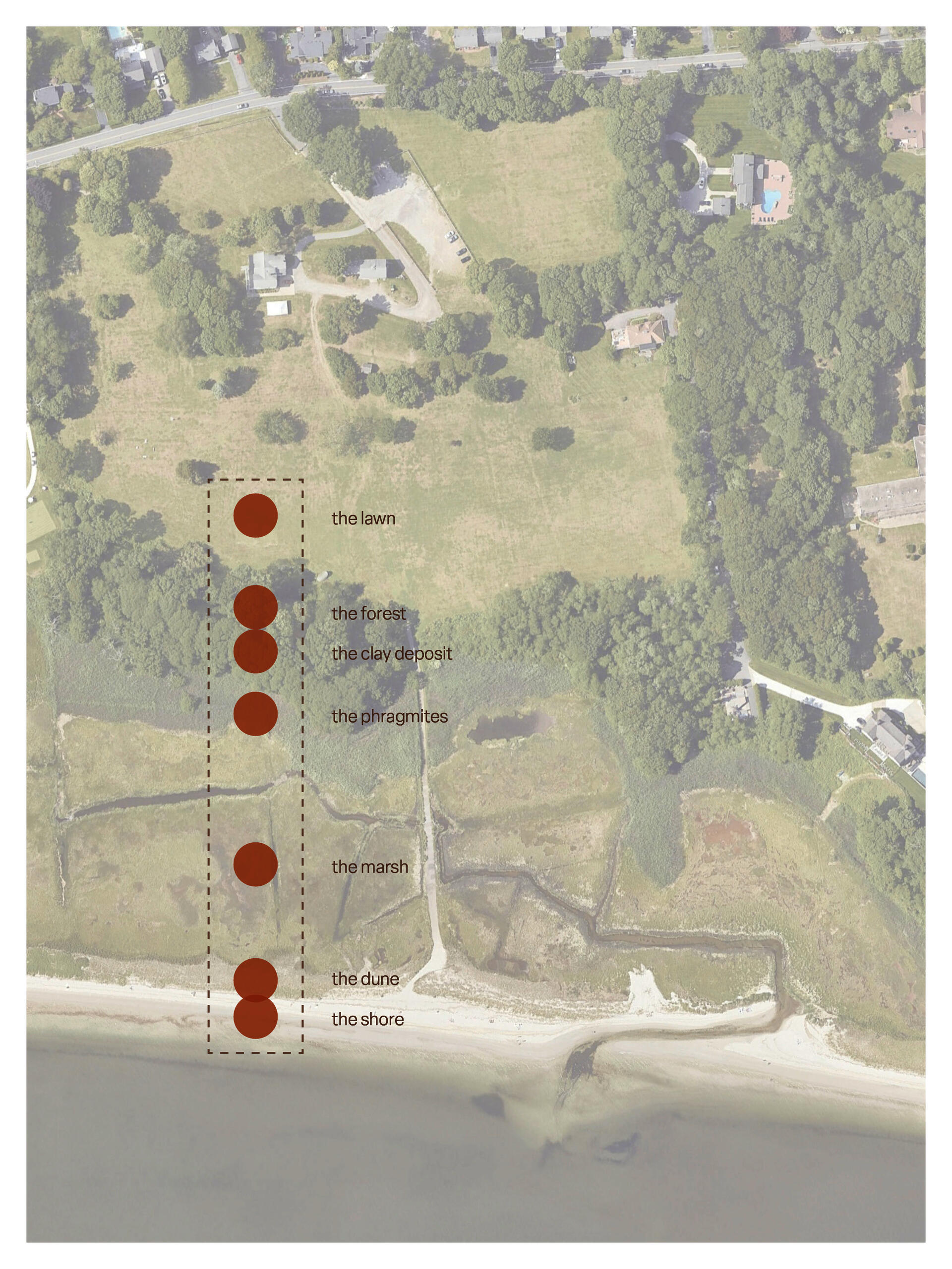
Spatial Context Map
Aerial map diagramming an area from bay to forest, marking locations where bowl-shaped ground casts were made along a transect at RISD Beach in Barrington, RI.
Image
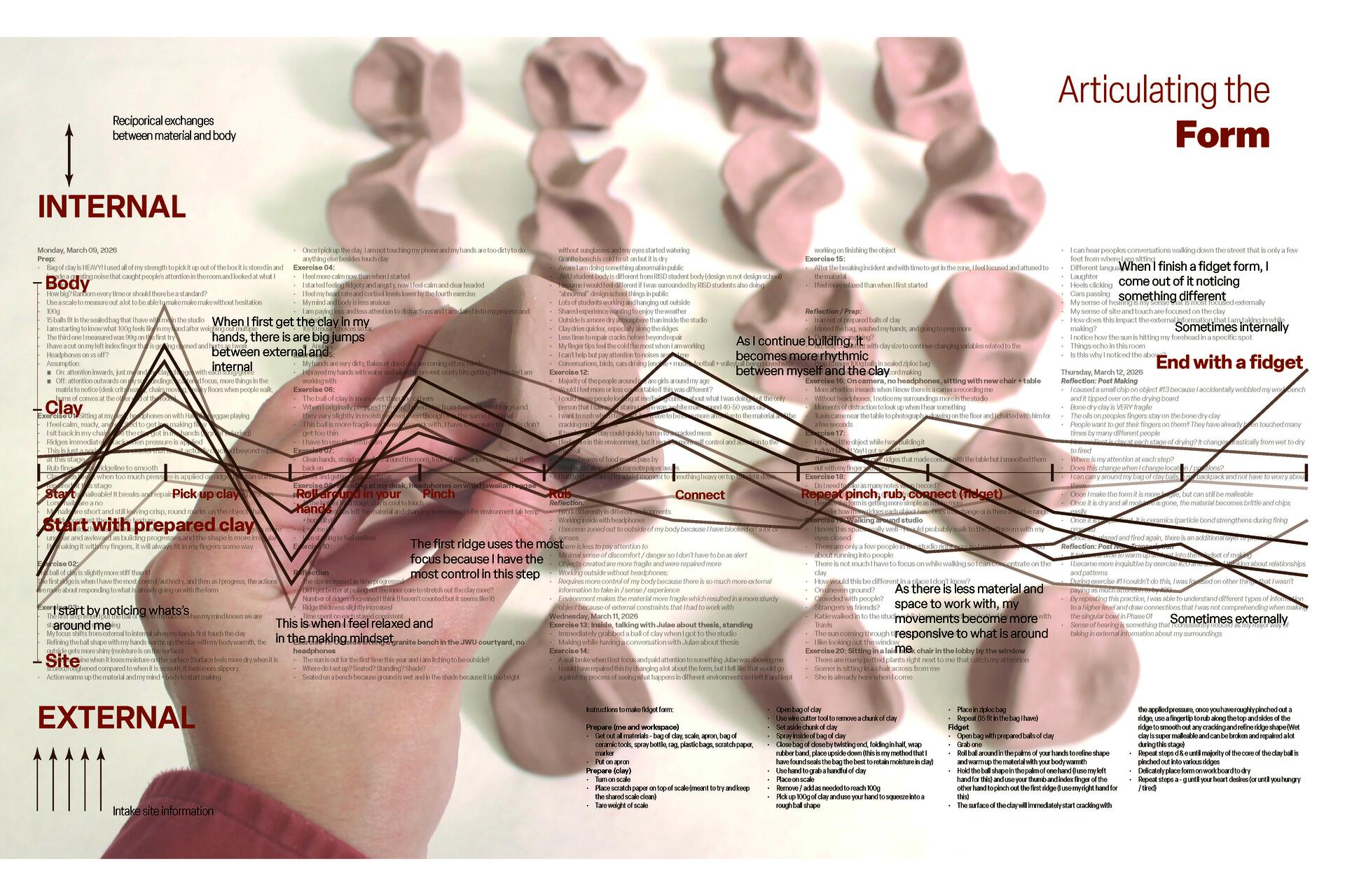
Diagram of Focus during an Iterative Making Process
This diagram maps shifts in attention during a repetitive form-making process. It compares how different conditions—such as walking in the landscape versus sitting in a studio—affect focus. Variables like environment, movement, and sensory input are introduced to show transitions between internal concentration and external awareness. The visual graph tracks how focus changes over time, highlighting the relationship between embodied movement and observational attention during making.
Image
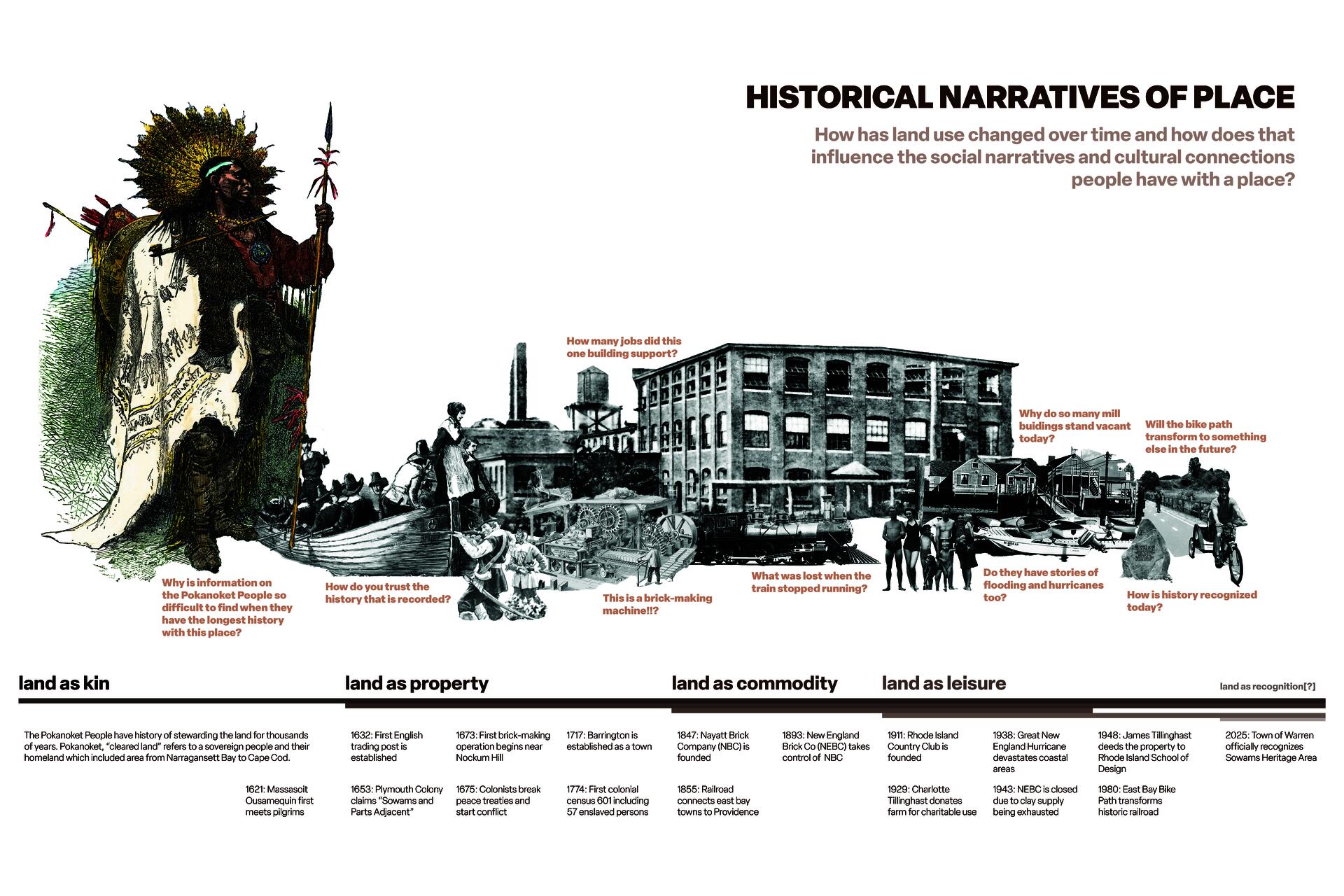
Historical Narratives Timeline
A timeline collage mapping changing relationships to land in Barrington, Rhode Island, from Indigenous stewardship to contemporary private land ownership land. The sequence layers historical imagery and text to show shifts in land management practices over time.
Image
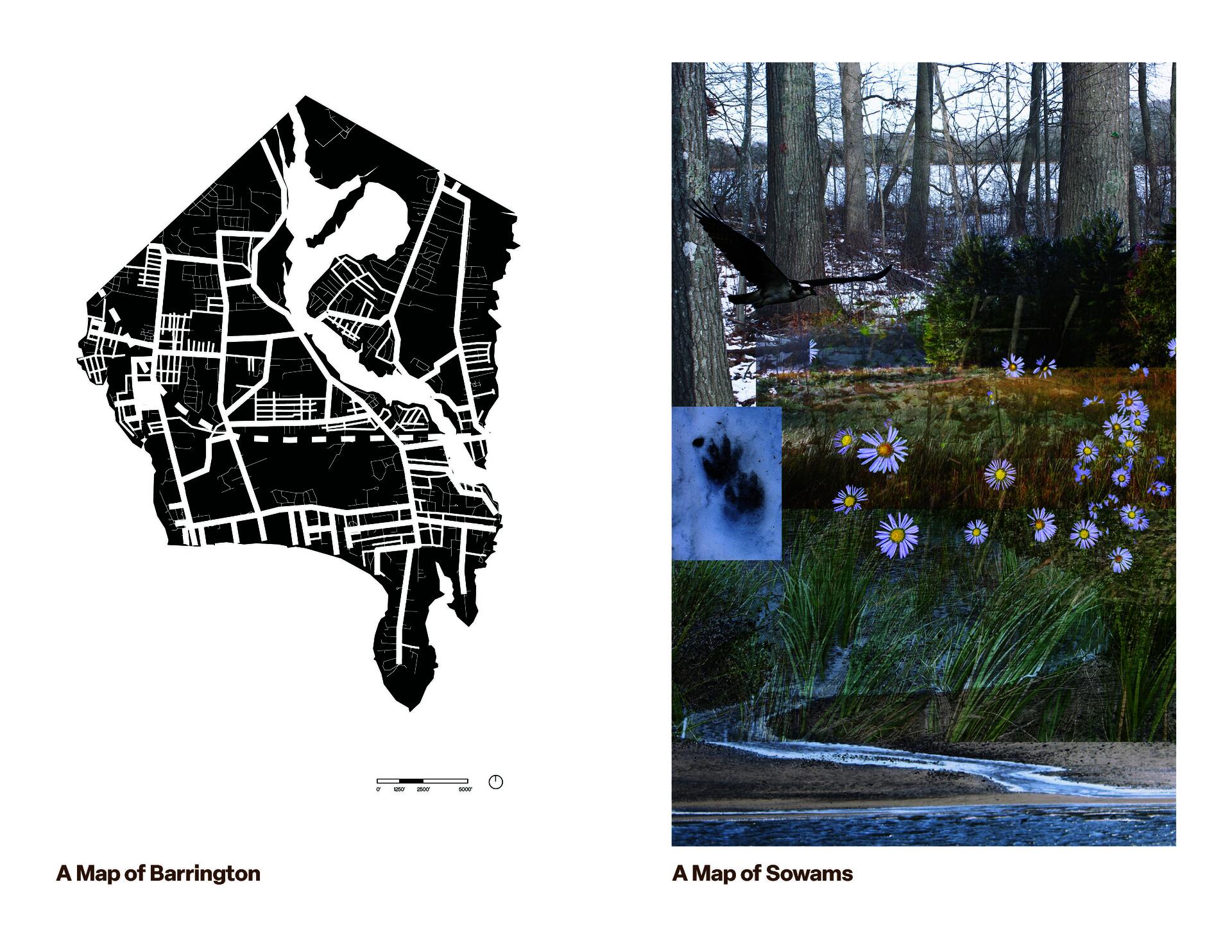
This paired mapping exercise compares two ways of representing the same landscape to explore how place names shape relationships to land and how different forms of representation communicate different kinds of knowledge. One map depicts Barrington in a conventional architectural style. The second map represents Sowams through a collage of images of plant communities that I observed and served as spatial cues for where I am in the landscape.
Image

Rhode Island School of Design
20 Washington Place
Providence, RI 02913–2784
United States of America
+1 401 454 6100
+1 800 364 RISD
QUICK LINKS
risd.edu
Graduate Studies
Image
Rhode Island School of Design
20 Washington Place
Providence, RI 02913–2784
United States of America
+1 401 454 6100
+1 800 364 RISD